Climate change (CC) induced sea level rise has a fairly straightforward impact on coastal estuarine wetlands: inundation and rising water levels resulting in the conversion of vegetated areas into areas of open water, with a consequent loss of wetland functions associated with the loss of vegetated wetlands. Wetlands have very specific water elevation tolerances. If the water is not deep enough, it is no longer a wetland. If the water is too deep, the area becomes open water rather than a vegetated wetland. Slowly rising waters on a gentle, continuously rising surface should result in a band of wetlands migrating landward.
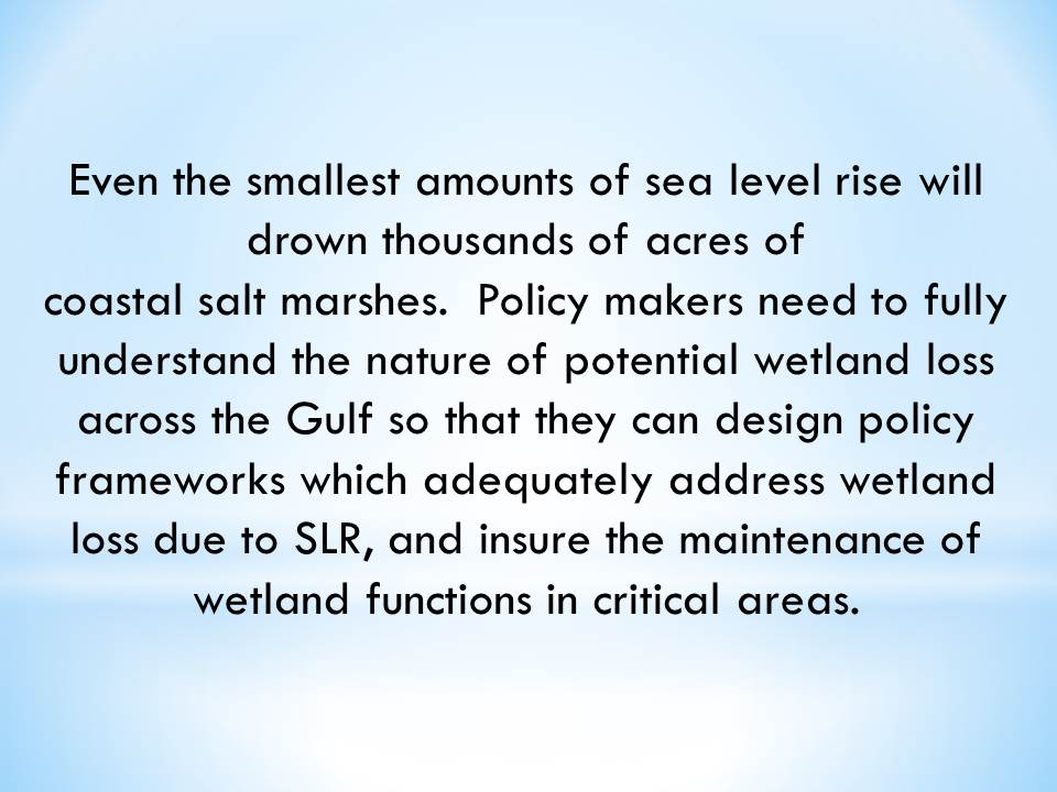
The loss of wetlands across the Gulf Coast as a result of sea level rise (SLR) will not be uniform. Some areas may lose most, if not all, of their existing fringing wetlands. Other areas, mainly those with gentle continuous slopes, may see wetlands migrate upslope, perhaps maintaining most wetland functions, if inundatable lands are available for the migration. Policy makers need to fully understand the nature of potential wetland loss across the Gulf so that they can design policy frameworks which adequately address wetland loss due to SLR, and insure the maintenance of wetland functions in critical areas.
Topography is Key
How quickly wetlands change because of SLR and CC is dependent to a large degree on the topography of the coastal zone, specifically the conformation of the coastal slope in the shoreline zone. In areas of uniform, gently increasing slope (see Fig. 1 below), we can expect that some new wetlands might form as new areas become inundated.
Conditions Favoring Wetland Migration (Scenario A in Figure 1)
- Gradual slope of land
- Minimal complexity in terms of swales, depressions, ridges, etc
- Surrounding land use is rural and undeveloped
- Climate change occurs over centuries rather than decades
Conditions Discouraging Wetland Migration (Scenario B in Figure 1)
- Steep slope of land
- Ridges and upraises in the land which block overflow
- Surrounding land use is urbanized, developed, and bulkheaded
- Climate change occurs rapidly over a few decades
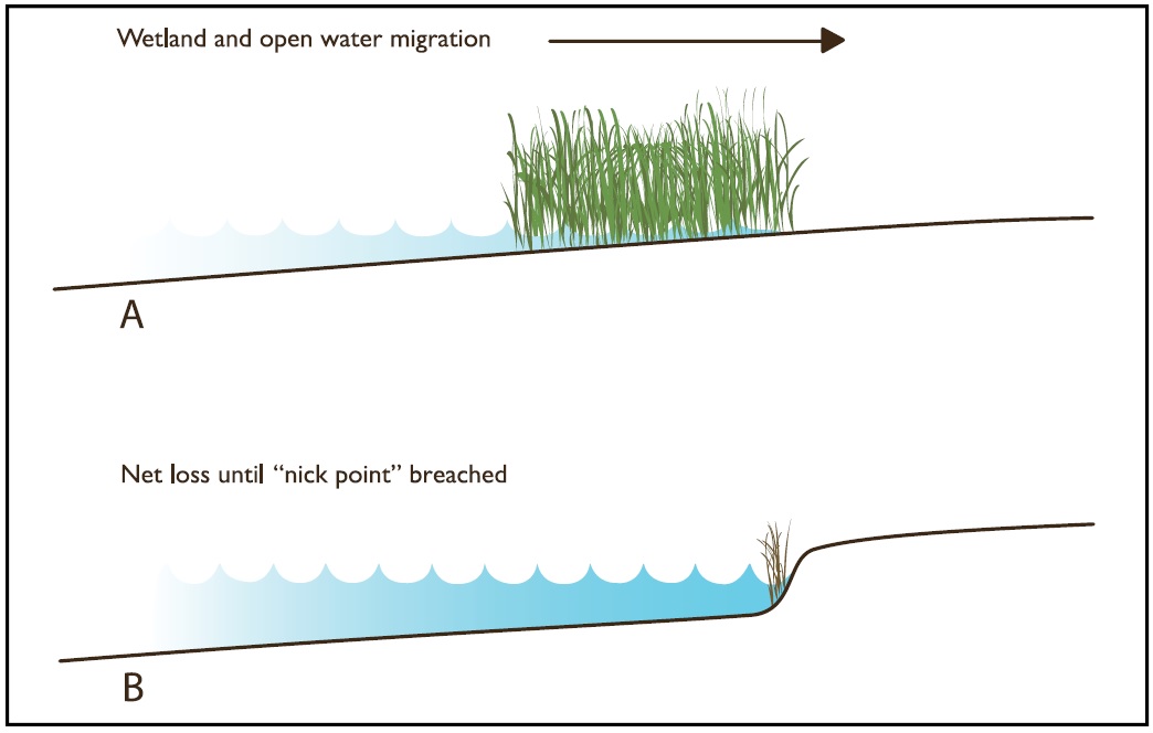
Figure 1. A) smooth slope with migrating band of wetlands and open water surfaces. B) notched slope with nick point impeding landward migration of wetlands until the point is breached by rising waters.
Slope
All shoreline gradients, of course, are not uniform. It should be noted that the steeper the slope, the more narrow the migrating wetland fringe will be, as the appropriate depths will occupy a much narrower range. There are many areas where there are disjunctions or discontinuities in the slope. For example, there may be notches or abrupt rises in the slope. This kind of a conformation will result in a very different scenario for wetland loss and replacement under conditions of rising sea level. Once rising waters reach the steeper zone, wetlands will be lost to open waters as the water becomes too deep for wetland vegetation. No new wetlands will form until the water levels rise above the steep slope and inundate the higher, gently sloping surface. How long it takes for the water to reach that point depends on the elevation of the higher surface and the rate of sea level rise. A gap of centuries could be involved. The higher level surface is at about 12-15 feet along much of the Texas Gulf Coast, for example.
Topography Complexity
Whether or not the formation of new wetlands through inundation would counter the loss of wetlands to rising water will depend on the details of the coastal surface: the complexity of the topography in terms of slope, swales, depressions, and overall drainage density.
Surrounding Land Use
To a very large degree, replacement will also depend on the nature of the land use in newly inundated areas. Developed and urbanized areas are not likely to be sacrificed to make room for new wetlands.
Rate of Climate Change
The replacement process also depends on the speed at which climate change- induced perturbations take place. Change could occur too fast (undefined here, but perhaps over a period of several decades rather than centuries) for stable ecosystem adaptation to occur. Thus, it is possible that wetland functions might not be replaced at the same rate they are lost even if topographic details were ideal for wetland replacement.
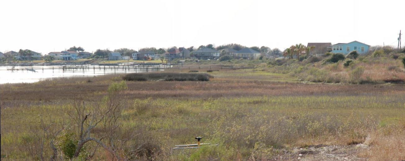
Galveston Bay, Texas as an Example
Gentle uniform slopes are common in the Gulf Coast in the extensive back bay system. Notched slopes, on the other hand, are common along riverine bays that formed when river valleys flooded as a result of geologic sea level rise at the end of the last Ice Age. Galveston Bay, one of the most important bays on the Gulf Coast in terms of fisheries, formed in the drowned valleys of the Trinity and San Jacinto Rivers during the last 12,000 years or so, has substantial bluffs or notches ringing the bay, some as high as 15 feet or more above sea level. Many, and perhaps most, of Galveston Bay’s fringing wetlands have been lost to human induced subsidence, with no corresponding migration of wetlands landward because of the abrupt slopes surrounding most of the Bay. (The rapidity of the subsidence and inundation was also a factor in the lack of replacement wetlands.) Many of the riverine bays along the Gulf of Mexico have this conformation.