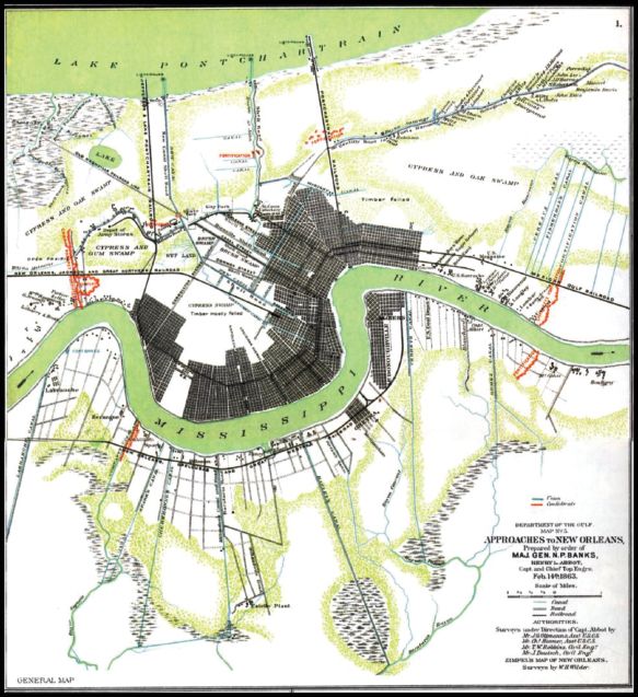
1863 Map of the City of New Orleans. Almost all of the developed area is on the high levee of the Mississippi River. The area north of the Gentilly Ridge (the ENE trending road in the upper right part of the map) and south of Lake Pontchartrain was not developed in full until the advent of the National Flood Insurance program in the 1960s. The 1863 urban pattern is a good example of proper site selection in a hazardous environment. The stippled light green zones indicate very low lying swampy areas. Most of the land area of this map is now developed (with large areas currently abandoned due to Hurricane Katrina). Most of the pre-Katrina population of New Orleans could fit into a slightly larger area than this 1863 footprint if it were built out at the densities of the French Quarter.
State and Local Legal Framework


